Waterproof Charts Northern Lake Michigan Navigation Chart 72

Waterproof Charts Northern Lake Michigan Navigation Chart 72

Regular price
Sold out
Sale price
$28.95
Shipping calculated at checkout.

Northern Lake Michigan Navigation Chart 72

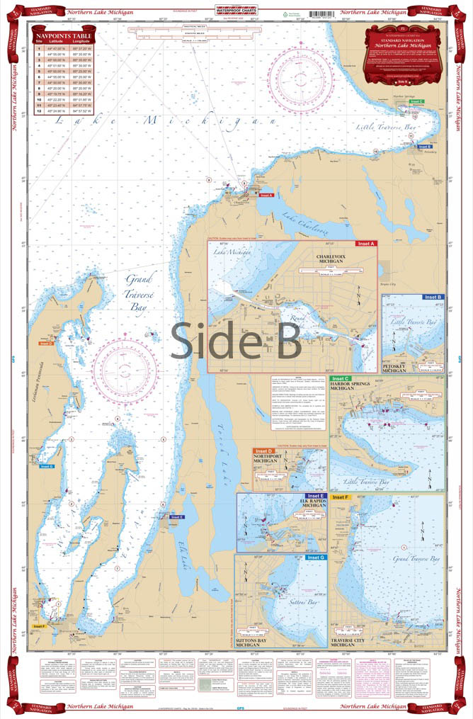
Overall coverage of the northern section of the lake from Frankfort, Michigan and Green Bay, Wisconsin, north to the Straits of Mackinac. Provides details for the Grays Reef Passage and the Washington Island, Wisconsin area. Covers all of Green Bay and Door County.